


Latest Version
Update
August 16, 2025
August 16, 2025
Developer
Sleek Mobile App
Sleek Mobile App
Categories
Design
Design
Platforms
Android
Android
Downloads
0
0
License
Free
Free
Package Name
com.gpsmap.camera.geotag.sleekapp
com.gpsmap.camera.geotag.sleekapp
Report
Report a Problem
Report a Problem
More About GPS Map Camera GeoTag & Photos
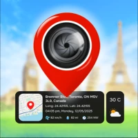
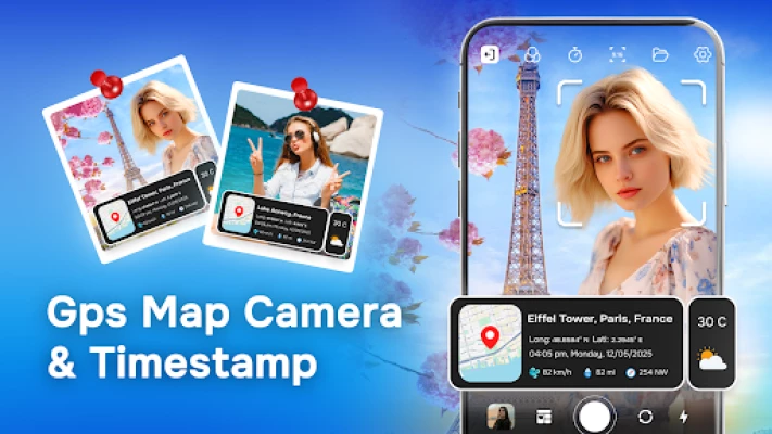
GPS Map Camera - Capture and Geotag Every Moment with Precision!
Geotag Photos app is the perfect solution for capturing photos with detailed information about the current location, date, time, map, weather, latitude, and longitude. This app enables you to easily create photos and folders for your memories, with complete coordinate data, ensuring that every memory is saved with accurate address and time information.
Geotag Photos GPS Map Camera Key Features:
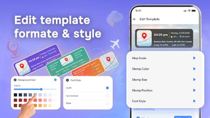
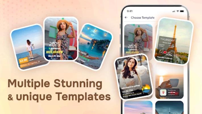
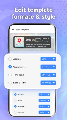
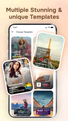
Customizable Template Options:
Select from a variety of template formats. For a customized look, change the stamp's text, color, size, and location.
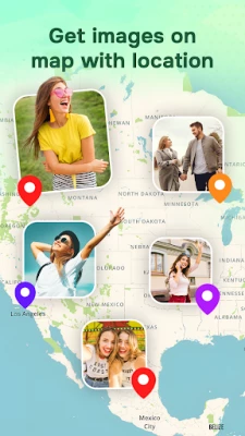
Auto Location Tagging:
Add latitude, longitude, and full address to each photo you click. No manual input is needed!
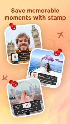
Smart Time & Date Stamp:
Mark your photos with the current date and time in various formats and styles.
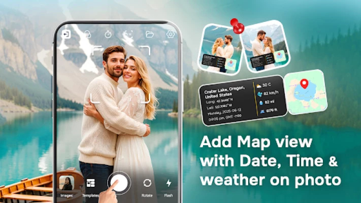
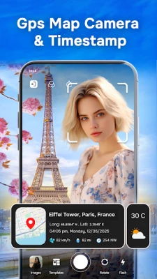
Customizable Map View:
Choose between Satellite, Terrain, or Normal map styles to display on your image.
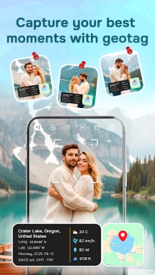
Weather Information:
Add the weather conditions right into your pictures, including temperature, humidity, height, etc.
Create Photo Folder:
Organize tagged photos in folders. Share instantly via email or social apps.
Geotag Photos GPS Map Camera Permission:
Enable some necessary permissions for capturing, saving, and geotagging photos. To fit your style, use customized templates.
Geotag Photos GPS Map Camera Key Features:
Customizable Template Options:
Select from a variety of template formats. For a customized look, change the stamp's text, color, size, and location.
Auto Location Tagging:
Add latitude, longitude, and full address to each photo you click. No manual input is needed!
Smart Time & Date Stamp:
Mark your photos with the current date and time in various formats and styles.
Customizable Map View:
Choose between Satellite, Terrain, or Normal map styles to display on your image.
Weather Information:
Add the weather conditions right into your pictures, including temperature, humidity, height, etc.
Create Photo Folder:
Organize tagged photos in folders. Share instantly via email or social apps.
Geotag Photos GPS Map Camera Permission:
Enable some necessary permissions for capturing, saving, and geotagging photos. To fit your style, use customized templates.
Rate the App
Add Comment & Review
User Reviews
Based on 0 reviews
No reviews added yet.
Comments will not be approved to be posted if they are SPAM, abusive, off-topic, use profanity, contain a personal attack, or promote hate of any kind.


More »

Popular Apps

Peacock TV: Stream TV & MoviesPeacock TV LLC

Mr.Billion: Idle Rich TycoonIDSIGames

WPS Office-PDF,Word,Sheet,PPTWPS SOFTWARE PTE. LTD.

Ludo King®Gametion
TCG Card Store Simulator 3DBlingames

FatsomaFatsoma Android
Statastic Basketball TrackerStatastic Solutions FlexCo

RealVNC Viewer: Remote DesktopRealVNC Limited

Gooka: Unlimited AI ChatALWAYS WITH YOU LLC.

Truth or Dare Game - OweeOwee
More »
Editor's Choice

Grim Soul: Dark Survival RPGBrickworks Games Ltd

Craft of Survival - Gladiators101XP LIMITED

Last Shelter: SurvivalLong Tech Network Limited
Dawn of Zombies: Survival GameRoyal Ark

Merge Survival : WastelandStickyHands Inc.

AoD Vikings: Valhalla GameRoboBot Studio

Viking Clan: RagnarokKano Games

Vikings: War of ClansPlarium LLC

Asphalt 9: LegendsGameloft SE

Modern Tanks: War Tank GamesXDEVS LTD